
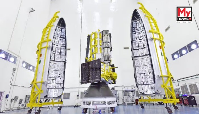
National: In a monumental stride for global Earth observation and a testament to enduring Indo-US partnership, the NASA-ISRO Synthetic Aperture Radar (NISAR) satellite is poised for launch today from the Satish Dhawan Space Centre in Sriharikota, Andhra Pradesh. This cutting-edge Earth observation satellite, a joint brainchild of the Indian Space Research Organisation (ISRO) and NASA, is set to revolutionise our understanding of the planet’s dynamic processes.
The lift-off of the 2,392 kg satellite, scheduled for 17:40 IST, will be carried out by ISRO’s Geosynchronous Satellite Launch Vehicle (GSLV-F16) into a sun-synchronous orbit. This marks a significant technical evolution for India’s space agency, as it is the first instance of a GSLV rocket being utilised for injecting a satellite into this specific orbit, traditionally the domain of the Polar Satellite Launch Vehicle (PSLV).
This collaborative mission is the culmination of over a decade of dedicated work between India and the United States, representing a combined investment exceeding $1.5 billion. NISAR’s sophisticated dual-band radar system is engineered to provide unprecedented high-resolution imagery of the Earth’s surface, enabling meticulous tracking of changes in land and ice globally, with repeat coverage every 12 days.
With an anticipated mission life of five years, NISAR will tirelessly orbit the planet every 97 minutes, constantly monitoring for even the minutest shifts in land surfaces, intricate ocean patterns, critical ice sheet dynamics, and agricultural variations. Its data is expected to be instrumental in monitoring natural hazards such as earthquakes, landslides, volcanic activity, and tsunamis, while also making substantial contributions to long-term climate and environmental research. The satellite is equipped with L-band and S-band synthetic aperture radars, allowing it to capture fully polarimetric and interferometric data. A highlight of its technological prowess is the advanced SweepSAR technique, which facilitates coverage of wider swaths of Earth without compromising on fine spatial resolution, crucial for detecting small-scale movements like soil shifts or glacier flows.
Beyond its impressive technical capabilities, NISAR embodies a pioneering open data policy. All observational data collected will be made freely available to the global community within one to two days, with near real-time access provided during emergency situations. This progressive approach is anticipated to be a boon for researchers, policy-makers, and disaster management agencies worldwide, particularly benefiting developing nations in their efforts to mitigate environmental challenges and respond to crises. The initial 90 days post-launch will be dedicated to rigorous in-orbit testing and calibration, ensuring the satellite is fully prepared for its critical science operations.